
Cloud Product Demonstration in Real Time
Information about cloud products in the PPS reference system
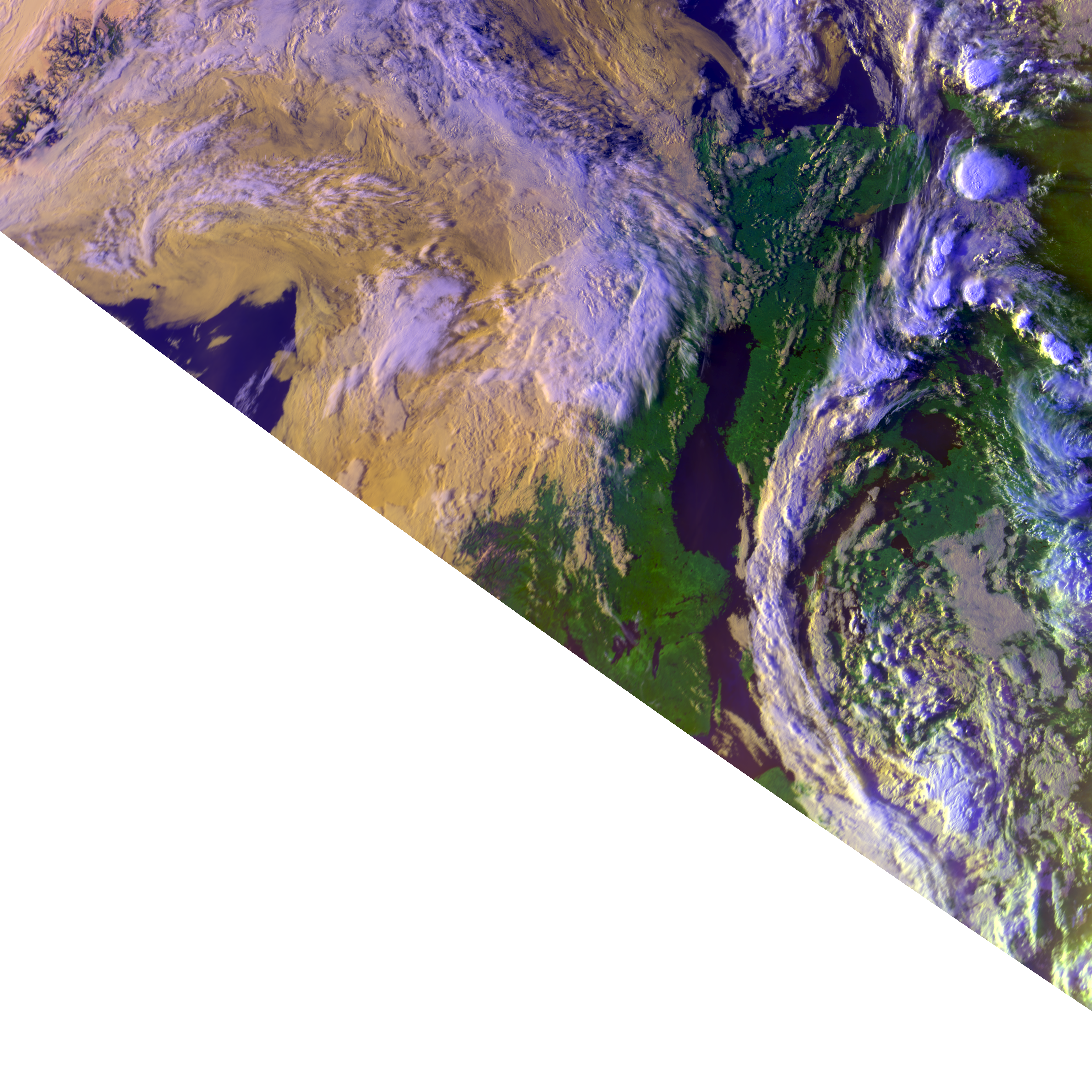
The cloud products
are generated operationally in real time at
SMHI,
on data from the direct readout
station in Norrköping. This is a part of
Nowcasting Satellite Application Facilities Polar Platform System
(NWC SAF/PPS) reference system.
The cloud product imagery shown here is based on
NWC SAF/PPS version 2021.
Satellite data
The satellite data used is mainly direct readout data from the X/L-band station in Norrköping. In addition to the local data also data from the EARS-AVHRR service received via EUMETCast are being used as well as, occasionally, direct readout data from neighbouring stations in Finland and Norway.
Data reception schedule
Here you can find the Direct Readout schedule of polar satellites being received in real time at the X/L-band station in Norrköping.
NWP-data
The numerical model used in the reference system is
ECMWF,
retrieved with a spatial resolution of 0.25° and a temporal
step of 3 hours, with base times of 00Z and 12Z. In addition to
the surface level, pressure levels at
1000/950/850/
RGB-images
Together with the PPS products is displayed one or a few RGB composite images. The following images are used, depending on satellite and instrument, and time of the day:
| Image name | Colour | Channel(s) |
|---|---|---|
| overview | ||
| red | 0.6 μm | |
| green | 0.9 μm | |
| blue | 11 μm | |
| night_overview | ||
| red | VIIRS DNB | |
| green | VIIRS DNB | |
| blue | 11 μm | |
| night_fog | ||
| red | 12 μm - 11 μm | |
| green | 11 μm - 3.7 μm | |
| blue | 11 μm |
More information about
RGB composites:
https://eumetrain.org/rgb-color-guide
https://satpy.readthedocs.io/en/stable/composites.html#built-in-compositors
Description of the default areas
The cloud products are retrieved on the satellite swath. The products are then mapped at various regional areas on, usually polar stereographic, map-projection. Areas may be added to or removed from the list of processing areas presented at this site.
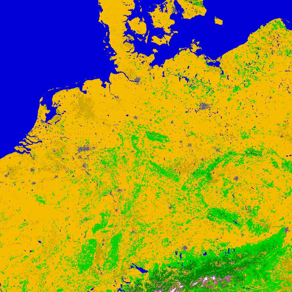
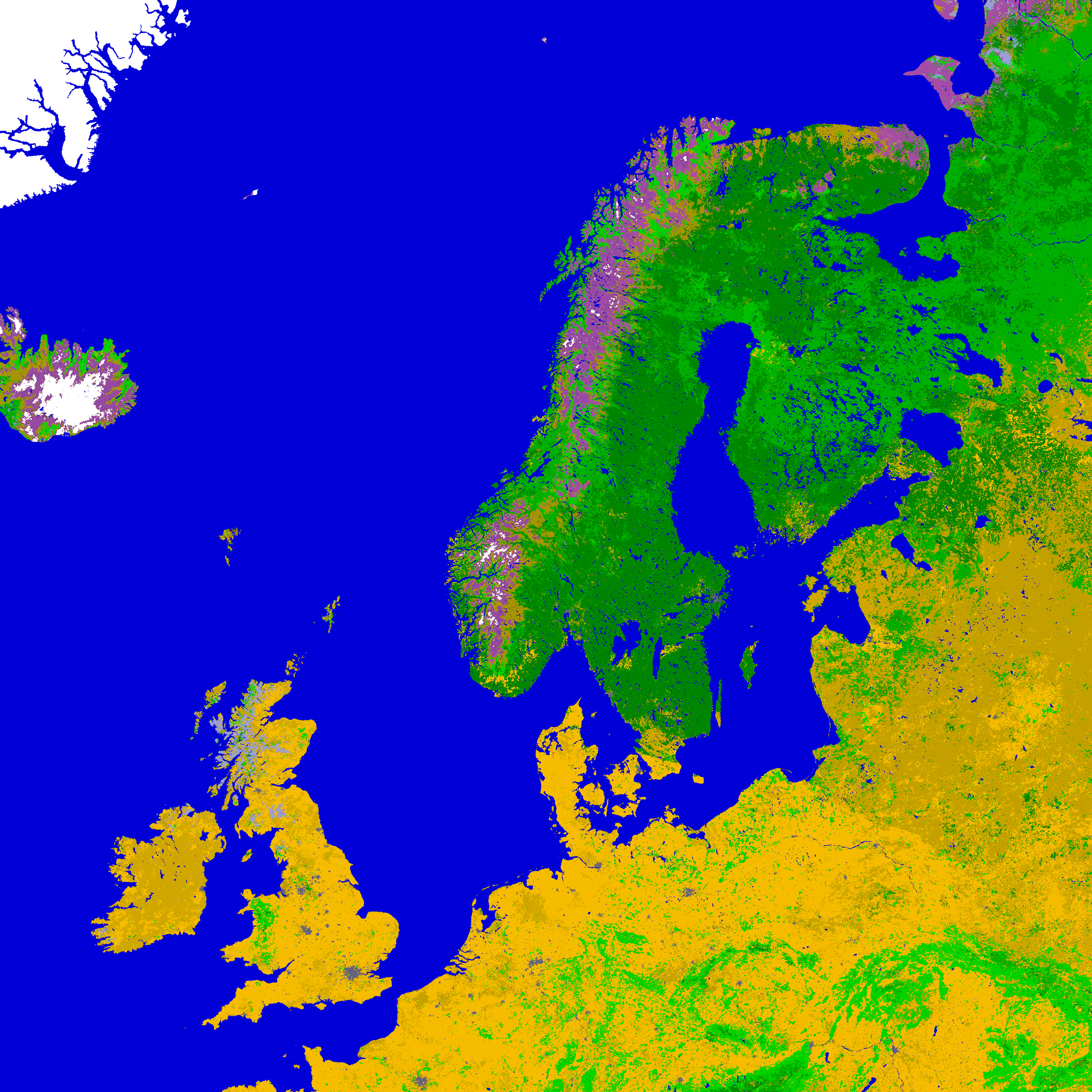
The location of the currently used areas in the
reference system are illustrated below, displaying the 1km
USGS
USGS landuse data used.
Germany is a small area in polar stereographic projection. This area is possible to cover from most direct readout stations in Europe.
Northern Europe 1km/px is a norther European area, in polar stereographic projection.