Cloud Mask (CMa) Description
Contents:

Goal of the Cloud Mask product
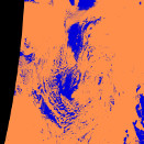
This product attempts to delineate all absolutely cloud-free pixels in a satellite scene with a high confidence. In addition, it will identify cloud free snow or ice contaminated pixels when illumination allows.
Cloud Mask algorithm summary
The (legacy) CMa algorithm is based on a multi-spectral threshold technique applied to each pixel of the satellite scene. The algorithm takes satellite imagery input from the sensors AVHRR, VIIRS or MODIS, on board the following satellite platforms: NOAA, Metop, SNPP/JPSS, and EOS-Terra/Aqua. Besides the satellite data the thresholding algorithm, takes the following as input:
- NWP short range forecast data
- 1 km GIS (digital elevation model and landuse) data
- Land emissivity maps
- OSISAF ice concentration (optional)
The scheme makes use of off-line radiative transfer simulations (6S and RTTOV) of cloud free atmospheres, to estimate, prior to the reception of satellite data, the optimal thresholds valid for the given satellite scene.
(In addition to the legacy categorical cloud mask as described above PPS also has a probablistic cloud mask algorithm. This algorithm uses the naïve Bayes approach to estimate the cloud probability of individual pixels. All AVHRR or AVHRR-like channels on other instruments are used. The dynamic threshold tables from the classic approach are used to simplify the problem.)
Cloud Mask output
The Cloud Mask output consists of:
- a five category cloud mask
- a binary cloud mask
- three quality/conditions flags
Main output
The main output is the cloud mask, which is presented in two ways: Either a binary cloud mask (cloud free/cloudy) or an extended cloud mask with more categories described. The extended cloud mask values are given by the five categories listed here:
| Value | Cloud Mask category name |
|---|---|
| 0 | Cloud free |
| 1 | Cloudy |
| 2 | Cloud contaminated |
| 3 | Snow/ice contaminated |
| 255 | No data |
The binary cloud mask has the values cloud free and cloudy only:
| Value | Cloud Mask category name |
|---|---|
| 0 | Cloud free |
| 1 | Cloudy |
| 255 | No data |

