Cloud Type (CT) Description
Contents:

Goal of the Cloud Type product
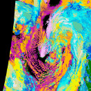
The main objective of the Cloud Type product is to distinguish between thin and opaque clouds, and provide a rough estimate of the cloud top height, and also try to distinguish between water particle clouds and ice particle clouds. The highest priority is given to the reliable identification of the major cloud categories: low, medium, high, and semi-transparent cirrus.
Cloud Type algorithm summary
The Cloud Type algorithm use input from the Cloud Mask and the Cloud Top Temperature and Height products. The algorithm distinguishes different cloud types using thresholds defined by off-line radiative transfer calculations and a database of interactively collected training targets. Similar to the cloud mask the cloud type algorithm takes satellite imagery input from the sensors AVHRR, VIIRS or MODIS, on board the following satellite platforms: NOAA, Metop, SNPP/JPSS, and EOS-Terra/Aqua. Besides the satellite data the thresholding algorithm, takes the following as input:
- NWP short range forecast data
- 1 km GIS (digital elevation model and landuse) data
- Land emissivity maps
Cloud Type outputs
The Cloud Type output consists of:
- a 15 category main output (Cloud classification)
- a multi-layer cloud dataset
- three quality/condition flags
Main output
| Class number | Class name |
|---|---|
| 1 | Cloud free land |
| 2 | Cloud free sea |
| 3 | Land contaminated by snow |
| 4 | Sea contaminated by snow/sea-ice |
| 5 | Very low clouds (cloud top less than 0.5km above ground) |
| 6 | Low clouds |
| 7 | Medium level clouds |
| 8 | High opaque clouds |
| 9 | Very high opaque clouds |
| 10 | Fractional clouds (sub-pixel water clouds) |
| 11 | High semi-transparent very thin cirrus |
| 12 | High semi-transparent thin cirrus |
| 13 | High semi-transparent thick cirrus |
| 14 | High semi-transparent cirrus above low or medium level clouds |
| 15 | High semi-transparent cirrus above snow or sea-ice |
| 255 | Non-processed / No data |

